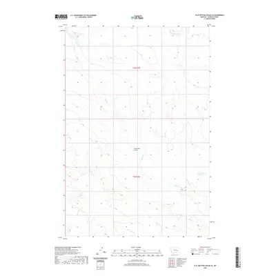
2020 Map of Flat Bottom Coulee SE
USGS Topo · Published 2020About this map
Flat Bottom Coulee and its associated drainages define the landscape of this Rosebud County interior, where the topography of t9n r39e and t10n r39e is shaped by persistent watercourses and catchments. The eastern portion of the area is anchored by Absolen Reservoir, a significant water feature in this otherwise arid environment. This 2020 survey provides a clear view of the complex hydrology feeding into larger systems, including Stellar Cr, Living Ash Cr, and Rattlesnake Cr. The map's detail is particularly useful for understanding local land management and water rights, showing how natural draws like N Prong Hay Cr intersect with public land survey sections to organize the terrain for ranching and resource use.
Find a feature on this map
8 named features on this map. Tap any name to fly to it.
Don’t see what you’re looking for? This feature index may not catch every label — zoom into the map to look around manually.
Map Details
Editions of this 2020 Flat Bottom Coulee SE Map
This is the sole edition of this map. No revisions or reprints were ever made.
Other maps of this area

1954 · Forsyth
USGS Topo · 1:250,000

1957 · Forsyth
USGS Topo · 1:250,000

1958 · Forsyth
USGS Topo · 1:250,000

1968 · Donleys Reservoir
USGS Topo · 1:24,000

1968 · Finch NE
USGS Topo · 1:24,000

1968 · Black Coulee
USGS Topo · 1:24,000

1969 · Rudie Coulee
USGS Topo · 1:24,000

1969 · Flat Bottom Coulee SW
USGS Topo · 1:24,000

1969 · Flat Bottom Coulee NE
USGS Topo · 1:24,000
1969 · Rough Creek SW
USGS Topo · 1:24,000