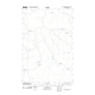
2011 Map of Flat Creek School
USGS Topo · Published 2011About this map
Flat Creek School (Historical) stands as a landmark of rural education in this section of Garfield County, where the landscape is defined by a sophisticated network of small-scale water management. Numerous dams, including Hammond Dam and the series at Twitchell Ranch, reflect the importance of water storage in this semi-arid environment. The terrain is marked by prominent drainage features such as Green Coulee and Thompson Coulee, which channel seasonal flows toward Flat Creek. Ranching infrastructure is central to the area's layout, with Burgess Rd and the New Flat Cr Rd providing access to isolated homesteads and reservoirs like the Burgess Reservoir Dam. This 2011 survey documents a remote ranching landscape where historical school sites and modern stock ponds coexist alongside traditional cattle operations.
Find a feature on this map
20 named features on this map. Tap any name to fly to it.
Don’t see what you’re looking for? This feature index may not catch every label — zoom into the map to look around manually.
Map Details
Editions of this 2011 Flat Creek School Map
This is the sole edition of this map. No revisions or reprints were ever made.
Other maps of this area

1954 · Jordan
USGS Topo · 1:250,000

1956 · Jordan
USGS Topo · 1:250,000

1958 · Jordan
USGS Topo · 1:250,000

1964 · Jordan
USGS Topo · 1:250,000

1964 · Bateman Coulee NE
USGS Topo · 1:24,000

1967 · Hagen Gap
USGS Topo · 1:24,000

1967 · Frank Coulee
USGS Topo · 1:24,000

1972 · Short Creek
USGS Topo · 1:24,000
1972 · Gilbert Creek SE
USGS Topo · 1:24,000

1972 · Flat Creek School
USGS Topo · 1:24,000