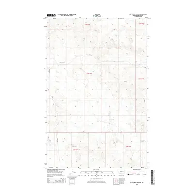
2014 Map of Flat Creek School
USGS Topo · Published 2014About this map
Flat Creek School stands as a focal point in this remote Garfield County landscape, situated where Twitchell Rd and New Flat Creek Rd converge. This 2014 survey reveals a rugged terrain defined by significant drainage systems, notably Flat Cr and its northern tributaries, Snap Cr and Lone Tree Cr. The map documents the intricate network of coulees that carve through the high plains, including the distinct formations of Thompson Coulee, Arnold Coulee, and Green Coulee.
Find a feature on this map
17 named features on this map. Tap any name to fly to it.
Don’t see what you’re looking for? This feature index may not catch every label — zoom into the map to look around manually.
Map Details
Editions of this 2014 Flat Creek School Map
This is the sole edition of this map. No revisions or reprints were ever made.
Other maps of this area

1954 · Jordan
USGS Topo · 1:250,000

1956 · Jordan
USGS Topo · 1:250,000

1958 · Jordan
USGS Topo · 1:250,000

1964 · Jordan
USGS Topo · 1:250,000

1964 · Bateman Coulee NE
USGS Topo · 1:24,000

1967 · Hagen Gap
USGS Topo · 1:24,000

1967 · Frank Coulee
USGS Topo · 1:24,000

1972 · Short Creek
USGS Topo · 1:24,000
1972 · Gilbert Creek SE
USGS Topo · 1:24,000

1972 · Flat Creek School
USGS Topo · 1:24,000