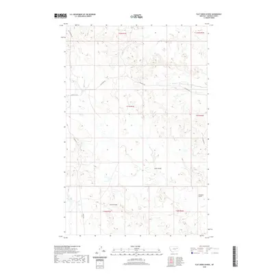
2020 Map of Flat Creek School
USGS Topo · Published 2020About this map
Flat Cr and its associated drainages define the landscape of this Garfield County quadrangle, showing a classic eastern Montana pattern of coulees and intermittent streams. The terrain is marked by significant topographical features such as Green Coulee, Arnold Coulee, and Thompson Coulee, which illustrate the complex erosion patterns of the region. A sparse network of roads, including the historical corridor of Old Flat Creek Rd and Van Norman Rd, provides the only access through this expansive ranching country. The map captures the remote character of the High Plains, where water sources like Snap Cr and Lone Tree Cr were historically vital for both livestock and early homesteaders navigating the breaks of the Missouri River watershed.
Find a feature on this map
16 named features on this map. Tap any name to fly to it.
Don’t see what you’re looking for? This feature index may not catch every label — zoom into the map to look around manually.
Map Details
Editions of this 2020 Flat Creek School Map
This is the sole edition of this map. No revisions or reprints were ever made.
Other maps of this area

1954 · Jordan
USGS Topo · 1:250,000

1956 · Jordan
USGS Topo · 1:250,000

1958 · Jordan
USGS Topo · 1:250,000

1964 · Jordan
USGS Topo · 1:250,000

1964 · Bateman Coulee NE
USGS Topo · 1:24,000

1967 · Hagen Gap
USGS Topo · 1:24,000

1967 · Frank Coulee
USGS Topo · 1:24,000

1972 · Short Creek
USGS Topo · 1:24,000
1972 · Gilbert Creek SE
USGS Topo · 1:24,000

1972 · Flat Creek School
USGS Topo · 1:24,000