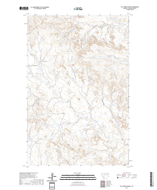
2024 Map of Flat Creek School
USGS Topo · Published 2024About this map
Flat Creek meanders through the central and southern portions of this Garfield County landscape, carving out a drainage network defined by deep coulees and intermittent stream beds. The terrain is structured by massive geographic depressions, most notably Green Coulee in the center and Thompson Coulee to the east, while Lone Tree Creek and Snap Creek mark the northern reaches. This rural area, surveyed recently by the U.S. Geological Survey, reflects a sparsely populated ranching or agricultural environment where infrastructure is limited to primitive and secondary routes such as Van Norman Rd and Old Flat Creek Rd. The Public Land Survey System grid clearly delineates the vast tracts of land, illustrating the geometric precision of western land management in modern Montana.
Find a feature on this map
16 named features on this map. Tap any name to fly to it.
Don’t see what you’re looking for? This feature index may not catch every label — zoom into the map to look around manually.
Map Details
Editions of this 2024 Flat Creek School Map
This is the sole edition of this map. No revisions or reprints were ever made.
Other maps of this area

1954 · Jordan
USGS Topo · 1:250,000

1956 · Jordan
USGS Topo · 1:250,000

1958 · Jordan
USGS Topo · 1:250,000

1964 · Jordan
USGS Topo · 1:250,000

1964 · Bateman Coulee NE
USGS Topo · 1:24,000

1967 · Hagen Gap
USGS Topo · 1:24,000

1967 · Frank Coulee
USGS Topo · 1:24,000

1972 · Short Creek
USGS Topo · 1:24,000
1972 · Gilbert Creek SE
USGS Topo · 1:24,000

1972 · Flat Creek School
USGS Topo · 1:24,000