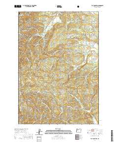
2020 Map of Flat Mountain
USGS Topo · Published 2020About this map
Siuslaw National Forest covers the western portion of this terrain, where the topography rises sharply toward Flat Mtn and Buck Peak. This Benton County landscape is defined by a dense network of drainage systems, with Greasy Cr, Beaver Cr, and Starr Cr carving deep valleys between prominent features like Franklin Ridge and Decker Ridge.
Find a feature on this map
63 named features on this map. Tap any name to fly to it.
Don’t see what you’re looking for? This feature index may not catch every label — zoom into the map to look around manually.
Map Details
Editions of this 2020 Flat Mountain Map
This is the sole edition of this map. No revisions or reprints were ever made.
Other maps of this area

1911 · Monroe
USGS Topo · 1:31,680

1911 · Inavale
USGS Topo · 1:31,680

1913 · Philomath
USGS Topo · 1:31,680

1921 · Corvallis
USGS Topo · 1:62,500

1922 · Monroe
USGS Topo · 1:62,500

1939 · Marys Peak
USGS Topo · 1:62,500

1939 · Monroe
USGS Topo · 1:62,500

1942 · Marys Peak
USGS Topo · 1:62,500

1942 · Alsea
USGS Topo · 1:62,500

1942 · Monroe
USGS Topo · 1:62,500