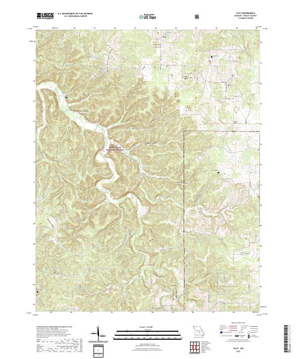
2021 Map of Flat
USGS Topo · Published 2021About this map
The settlement of Flat sits atop the high ground of Phelps County, overlooking a complex network of hollows and ridges characteristic of the northern Ozarks. This 2021 survey of the Mark Twain National Forest reveals a landscape defined by its hydrology, where significant water sources like Cave Spring and Kelly Spring feed into the winding Spring Cr and Mill Cr. The map preserves the locations of several burial grounds, including Trout Cemetery, Cowan Cem, and Belfe Cem, which provide essential points of reference for genealogists tracking local families. The terrain is marked by distinctive names such as Democrat Ridge and Tie Ridge, separated by deep drainage features like Ash Spring Hollow and Lawrence Hollow. The modern road network, including State Highway T and State Hwy M, follows the ancient contours of the land, connecting scattered homesteads and private drives to the larger regional thoroughfares.
Find a feature on this map
49 named features on this map. Tap any name to fly to it.
Don’t see what you’re looking for? This feature index may not catch every label — zoom into the map to look around manually.
Map Details
Editions of this 2021 Flat Map
This is the sole edition of this map. No revisions or reprints were ever made.
Other maps of this area

1912 · Rolla
USGS Topo · 1:62,500

1936 · Waynesville
USGS Topo · 1:48,000

1937 · Edgar Springs
USGS Topo · 1:48,000

1941 · Big Piney
USGS Topo · 1:62,500

1942 · Waynesville
USGS Topo · 1:62,500

1943 · Big Piney
USGS Topo · 1:62,500

1944 · Waynesville
USGS Topo · 1:62,500

1945 · Edgar Springs
USGS Topo · 1:62,500

1949 · Rolla
USGS Topo · 1:250,000
1950 · Kaintuck Hollow
USGS Topo · 1:24,000