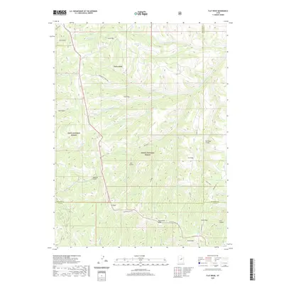
2020 Map of Flat Ridge
USGS Topo · Published 2020About this map
Three Forks sits at the northern end of this high-elevation landscape, where the confluence of drainages defines the local geography. The map captures a high-country transition zone where the Uinta National Forest meets the Ashley National Forest. Human infrastructure is centered on the ridgetops, most notably along Reservation Ridge Rd, which follows the southern boundary near Cat Peak. The terrain is characterized by a complex network of canyons and ridges, such as Horse Ridge and Long Ridge, providing a look at the natural water sources critical to this arid environment, including Bown Corral Reservoir and numerous named springs like Indian Spring and Grassy Spring. This topographic record illustrates how the high ridges serve as natural corridors for transit and boundary lines between Wasatch, Duchesne, and Utah Counties.
Find a feature on this map
47 named features on this map. Tap any name to fly to it.
Don’t see what you’re looking for? This feature index may not catch every label — zoom into the map to look around manually.
Map Details
Editions of this 2020 Flat Ridge Map
This is the sole edition of this map. No revisions or reprints were ever made.
Other maps of this area

1885 · Salt Lake
USGS Topo · 1:250,000

1885 · Manti
USGS Topo · 1:250,000

1885 · Uinta
USGS Topo · 1:250,000

1886 · Price River
USGS Topo · 1:250,000

1895 · Manti
USGS Topo · 1:250,000

1896 · Price River
USGS Topo · 1:250,000

1907 · Strawberry Valley
USGS Topo · 1:125,000

1909 · Strawberry Valley
USGS Topo · 1:125,000

1939 · Soldier Summit
USGS Topo · 1:62,500

1942 · Soldier Summit
USGS Topo · 1:62,500