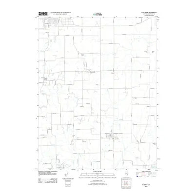
2012 Map of Flat Rock
USGS Topo · Published 2012About this map
The rural landscape of Crawford County is defined by its numerous small burial grounds and a trio of unincorporated settlements. New Hebron, Duncanville, and Morea serve as the primary community hubs, linked by a strict grid of agricultural roads such as E 950th Ave and N 1100th St. The territory is drained by several meandering waterways, including Lamotte Creek and Brushy Creek, which wind through the farmland. Of particular interest to genealogists is the unusually high density of family and community cemeteries scattered across the township, such as Good Hope Cem, Tohill Cem, and Swearingen Cem. These markers of early settlement patterns remain preserved even as the landscape continues its modern agricultural use, with Campbell Lake anchoring the southeastern corner of the quadrangle.
Find a feature on this map
89 named features on this map. Tap any name to fly to it.
Don’t see what you’re looking for? This feature index may not catch every label — zoom into the map to look around manually.
Map Details
Editions of this 2012 Flat Rock Map
This is the sole edition of this map. No revisions or reprints were ever made.
Other maps of this area

1910 · Hardinville
USGS Topo · 1:62,500

1917 · Birds
USGS Topo · 1:62,500

1942 · Birds
USGS Topo · 1:62,500

1943 · Merom
USGS Topo · 1:24,000

1953 · Indianapolis
USGS Topo · 1:250,000

1956 · Indianapolis
USGS Topo · 1:250,000

1956 · Annapolis
USGS Topo · 1:62,500

1956 · Vincennes
USGS Topo · 1:250,000

1957 · Indianapolis
USGS Topo · 1:250,000

1957 · Vincennes
USGS Topo · 1:250,000