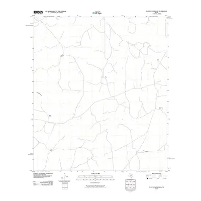
2010 Map of Flat Rock Draw SE
USGS Topo · Published 2010About this map
Family ranching operations define the remote landscape of this Val Verde County locale, where established holdings like the Adah Cauthorn Ranch and Glasscock Ranch are connected by a network of local roads and unimproved tracks. The terrain is marked by seasonal watercourses and drainage patterns, most notably Flat Rock Draw in the west and Buckley Draw in the southeast. These geographic features dictate the positioning of rural homesteads, including Keene Ranch, Ray Ranch, and Johnson Ranch. The U.S. Geological Survey documentation from this period shows the sparse but persistent settlement of the Texas backcountry, where Martin Ranch and other properties anchor a vast, open territory defined more by family name and topography than by urban development.
Find a feature on this map
8 named features on this map. Tap any name to fly to it.
Don’t see what you’re looking for? This feature index may not catch every label — zoom into the map to look around manually.
Map Details
Editions of this 2010 Flat Rock Draw SE Map
This is the sole edition of this map. No revisions or reprints were ever made.
Other maps of this area

1954 · Sonora
USGS Topo · 1:250,000

1958 · Sonora
USGS Topo · 1:250,000

1967 · Dunbar Draw SW
USGS Topo · 1:24,000

1967 · Flat Rock Draw SE
USGS Topo · 1:24,000

1967 · Dunbar Draw NW
USGS Topo · 1:24,000

1967 · Flat Rock Draw SW
USGS Topo · 1:24,000

1967 · Shafter Draw
USGS Topo · 1:24,000

1967 · Hudspeth Draw
USGS Topo · 1:24,000

1973 · Turney Draw NW
USGS Topo · 1:24,000

1973 · White Draw NW
USGS Topo · 1:24,000