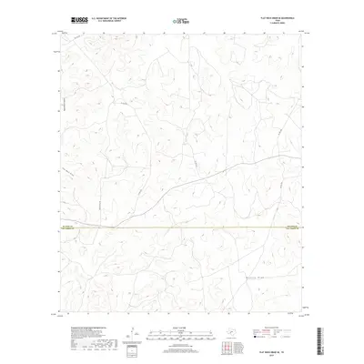
2019 Map of Flat Rock Draw SE
USGS Topo · Published 2019About this map
Sutton and Val Verde counties meet in this arid expanse of West Texas, where the landscape is defined by the winding paths of intermittent drainage systems. The northern portion of the map is dominated by the steep topography of Ogels Road Canyon, while the southern reaches are marked by the wide, sprawling course of Buckley Draw. Transportation in this ranching country is almost exclusively limited to private access, with Green Ranch Rd providing a primary artery through the center of the sheet alongside various numbered private routes like Pvt Rd 4434. This survey illustrates a classic Edwards Plateau drainage pattern, where Flat Rock Draw and other seasonal waterways have carved intricate relief into the limestone-based terrain of the high desert, far from established town centers.
Find a feature on this map
10 named features on this map. Tap any name to fly to it.
Don’t see what you’re looking for? This feature index may not catch every label — zoom into the map to look around manually.
Map Details
Editions of this 2019 Flat Rock Draw SE Map
This is the sole edition of this map. No revisions or reprints were ever made.
Other maps of this area

1954 · Sonora
USGS Topo · 1:250,000

1958 · Sonora
USGS Topo · 1:250,000

1967 · Dunbar Draw SW
USGS Topo · 1:24,000

1967 · Flat Rock Draw SE
USGS Topo · 1:24,000

1967 · Dunbar Draw NW
USGS Topo · 1:24,000

1967 · Flat Rock Draw SW
USGS Topo · 1:24,000

1967 · Shafter Draw
USGS Topo · 1:24,000

1967 · Hudspeth Draw
USGS Topo · 1:24,000

1973 · Turney Draw NW
USGS Topo · 1:24,000

1973 · White Draw NW
USGS Topo · 1:24,000