
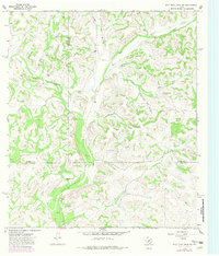
1967 Map of Flat Rock Draw SW
USGS Topo · Published 1970About this map
Cattle and sheep ranching define the landscape of the Edwards Plateau in the late 1960s, where the convergence of Crockett, Sutton, and Val Verde counties creates a patchwork of family-owned holdings. The terrain is dominated by a complex network of dry washes and canyons, most notably the Devils River and its fork, the Dry Devils River. Large tracts of land belong to established ranching families, including the Phillips Ranch, Hunt Ranch, and Hunnicutt Ranch, illustrating the sparse but enduring settlement pattern of the Texas Hill Country.
Find a feature on this map
22 named features on this map. Tap any name to fly to it.
Don’t see what you’re looking for? This feature index may not catch every label — zoom into the map to look around manually.
Map Details
Editions of this 1967 Flat Rock Draw SW Map
2 editions found
Other maps of this area

1954 · Sonora
USGS Topo · 1:250,000

1958 · Sonora
USGS Topo · 1:250,000

1967 · Flat Rock Draw SE
USGS Topo · 1:24,000

1967 · Shafter Draw
USGS Topo · 1:24,000

1967 · Hudspeth Draw
USGS Topo · 1:24,000

1969 · Wild Horse Canyon
USGS Topo · 1:24,000

1970 · Juno
USGS Topo · 1:24,000

1970 · Brushy Draw
USGS Topo · 1:24,000

1973 · White Draw NW
USGS Topo · 1:24,000
1973 · White Draw NE
USGS Topo · 1:24,000