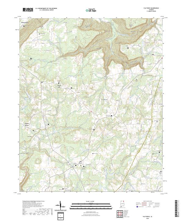
2024 Map of Flat Rock
USGS Topo · Published 2024About this map
Sand Mountain dominates this portion of the Cumberland Plateau, where the tableland is deeply etched by numerous gulfs and drainage branches. The landscape is defined by its rural community structure, anchored by small settlements like Liberty Hill and Flat Rock. Genealogists will find a high density of family-named landmarks and burial grounds, including the Flat Rock Cem, Pritchett Cem, and Morris Cem situated along the many county roads that crisscross the plateau. The topography is particularly striking where the plateau edges drop off into Newby Gulf and Bryant Gulf, with the eastern boundary marked by the Jackson and DeKalb County line. Water features such as Hogue Creek and Long Creek navigate the high ground, while more secluded features like Wolf Lake are tucked into the western slopes.
Find a feature on this map
124 named features on this map. Tap any name to fly to it.
Don’t see what you’re looking for? This feature index may not catch every label — zoom into the map to look around manually.
Map Details
Editions of this 2024 Flat Rock Map
This is the sole edition of this map. No revisions or reprints were ever made.
Other maps of this area

1886 · Stevenson
USGS Topo · 1:125,000

1892 · Stevenson
USGS Topo · 1:125,000

1895 · Stevenson
USGS Topo · 1:125,000

1936 · Trenton
USGS Topo · 1:24,000

1936 · Ider
USGS Topo · 1:24,000

1936 · Shellmound
USGS Topo · 1:24,000

1936 · Bridgeport
USGS Topo · 1:24,000

1936 · Flat Rock
USGS Topo · 1:24,000

1936 · Sulphur Springs
USGS Topo · 1:24,000

1936 · Stevenson
USGS Topo · 1:24,000