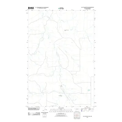
2011 Map of Flat Top Butte NE
USGS Topo · Published 2011About this map
O'Fallon Creek and its network of tributaries define this landscape in Prairie County, where water management is central to the local geography. The map documents several engineered water features essential for land use in this part of Montana, including Shumaker Number 2 Dam and Hyde Number 2 Dam. These structures, along with the Airport Reservoir, reflect a focused effort to capture seasonal runoff from seasonal drainages like Whitney Creek and Dunwoodie Creek. The presence of the Evertz Ranch near the center of the sheet provides a specific point of reference for local history and genealogical research. Transportation is sparse, primarily consisting of unpaved routes such as Flat Top Rd and Whitney Creek Rd that follow the natural contours of the drainages.
Find a feature on this map
10 named features on this map. Tap any name to fly to it.
Don’t see what you’re looking for? This feature index may not catch every label — zoom into the map to look around manually.
Map Details
Editions of this 2011 Flat Top Butte NE Map
This is the sole edition of this map. No revisions or reprints were ever made.
Other maps of this area

1953 · Miles City
USGS Topo · 1:250,000

1957 · Miles City
USGS Topo · 1:250,000

1958 · Miles City
USGS Topo · 1:250,000

1966 · Fallon
USGS Topo · 1:24,000

1966 · Marsh SW
USGS Topo · 1:24,000

1969 · Little Whitney Creek
USGS Topo · 1:24,000

1969 · Flat Top Butte SW
USGS Topo · 1:24,000

1969 · Flat Top Butte
USGS Topo · 1:24,000

1969 · Flat Top Butte NE
USGS Topo · 1:24,000
1972 · Fallon SW
USGS Topo · 1:24,000