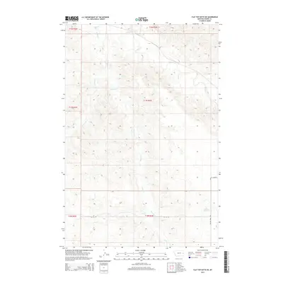
2014 Map of Flat Top Butte NE
USGS Topo · Published 2014About this map
O'Fallon Cr and its tributaries carve a network of drainages across this section of Prairie County, defining the drainage patterns of the eastern Montana landscape. The area is characterized by high-elevation divides and deep creek beds, including Whitney Cr, Fox Cr, and Dunwoodie Cr. These natural watercourses dictated the placement of early infrastructure, such as the Flat Top Rd and Whitney Creek Rd, which follow the natural contours of the land. In the southeastern corner, the Airport Reservoir provides a managed water source amidst the arid breaks. The map captures the organized layout of the Public Land Survey System, showing the townships from t12n r52e down to t10n r53e, illustrating how ranching and land management were structured around these vital prairie waterways.
Find a feature on this map
13 named features on this map. Tap any name to fly to it.
Don’t see what you’re looking for? This feature index may not catch every label — zoom into the map to look around manually.
Map Details
Editions of this 2014 Flat Top Butte NE Map
This is the sole edition of this map. No revisions or reprints were ever made.
Other maps of this area

1953 · Miles City
USGS Topo · 1:250,000

1957 · Miles City
USGS Topo · 1:250,000

1958 · Miles City
USGS Topo · 1:250,000

1966 · Fallon
USGS Topo · 1:24,000

1966 · Marsh SW
USGS Topo · 1:24,000

1969 · Little Whitney Creek
USGS Topo · 1:24,000

1969 · Flat Top Butte SW
USGS Topo · 1:24,000

1969 · Flat Top Butte
USGS Topo · 1:24,000

1969 · Flat Top Butte NE
USGS Topo · 1:24,000
1972 · Fallon SW
USGS Topo · 1:24,000