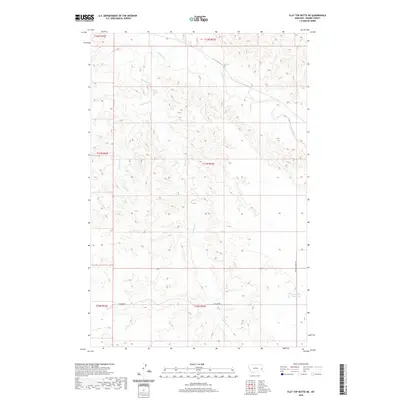
2020 Map of Flat Top Butte NE
USGS Topo · Published 2020About this map
O'Fallon Cr and its various tributaries define the drainage patterns of this Prairie County landscape, where the high plains break into a network of seasonal coulees and creek beds. The map illustrates a primarily rural ranching or agricultural environment, marked by isolated water sources such as the Airport Reservoir in the southeast. Movement through this portion of eastern Montana is facilitated by a sparse network of unpaved corridors, most notably Flat Top Rd and Whitney Creek Rd. These routes follow the natural contours of the land, connecting the drainages of Whitney Cr, Dunwoodie Cr, and Fox Cr. The lack of concentrated settlements highlights the open, expansive nature of the region in the early 21st century, making it a valuable reference for understanding contemporary land use and water management in the Montana badlands.
Find a feature on this map
13 named features on this map. Tap any name to fly to it.
Don’t see what you’re looking for? This feature index may not catch every label — zoom into the map to look around manually.
Map Details
Editions of this 2020 Flat Top Butte NE Map
This is the sole edition of this map. No revisions or reprints were ever made.
Other maps of this area

1953 · Miles City
USGS Topo · 1:250,000

1957 · Miles City
USGS Topo · 1:250,000

1958 · Miles City
USGS Topo · 1:250,000

1966 · Fallon
USGS Topo · 1:24,000

1966 · Marsh SW
USGS Topo · 1:24,000

1969 · Little Whitney Creek
USGS Topo · 1:24,000

1969 · Flat Top Butte SW
USGS Topo · 1:24,000

1969 · Flat Top Butte
USGS Topo · 1:24,000

1969 · Flat Top Butte NE
USGS Topo · 1:24,000
1972 · Fallon SW
USGS Topo · 1:24,000