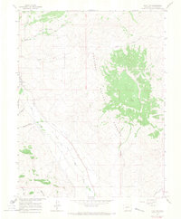
1964 Map of Flat Top
USGS Topo · Published 1967About this map
Gunnison National Forest dominates the eastern landscape of this Gunnison County region, anchored by the massive high-altitude plateau of Flat Top. The western portion of the terrain transitions into a complex network of agricultural and hydrological engineering, where water management is central to the local economy. An Old Railroad Grade follows the contours of the valley floor, tracing a path alongside Ohio Creek, illustrating the historical transportation routes that once serviced this part of the Colorado interior.
Find a feature on this map
19 named features on this map. Tap any name to fly to it.
Don’t see what you’re looking for? This feature index may not catch every label — zoom into the map to look around manually.
Map Details
Editions of this 1964 Flat Top Map
3 editions found
Other maps of this area

1888 · Crested Butte
USGS Topo · 1:62,500

1888 · Anthracite
USGS Topo · 1:62,500

1889 · Crested Butte
USGS Topo · 1:62,500

1889 · Anthracite
USGS Topo · 1:62,500

1893 · Anthracite
USGS Topo · 1:62,500

1893 · Crested Butte
USGS Topo · 1:62,500

1894 · Anthracite
USGS Topo · 1:62,500

1954 · Mc Intosh Mountain
USGS Topo · 1:24,000

1954 · Gunnison
USGS Topo · 1:24,000

1956 · Montrose
USGS Topo · 1:250,000