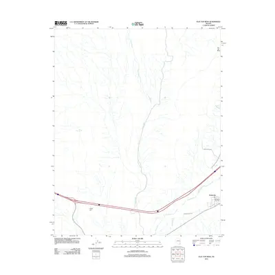
2012 Map of Flat Top Mesa
USGS Topo · Published 2012About this map
Bunkerville anchors the southeast corner of this Virgin Valley landscape, where the Bunkerville Ditch draws from the Virgin River to support local agriculture. The terrain transitions from the river's path toward the elevated Flat Top Mesa and Virgin Hill, cut by the extensive drainage system of Toquop Wash. In this early 21st-century view, the Bunkerville Post Office serves as a central landmark for the small community, while the Sink Reservoir and isolated roads like Ben Franklin Way reflect the desert's sparse development. The map details the intersection of vital water management and the rugged topography typical of this Clark County region.
Find a feature on this map
9 named features on this map. Tap any name to fly to it.
Don’t see what you’re looking for? This feature index may not catch every label — zoom into the map to look around manually.
Map Details
Editions of this 2012 Flat Top Mesa Map
This is the sole edition of this map. No revisions or reprints were ever made.
Other maps of this area

1886 · Saint Thomas
USGS Topo · 1:250,000

1893 · Saint Thomas
USGS Topo · 1:250,000

1954 · Las Vegas
USGS Topo · 1:250,000

1957 · Las Vegas
USGS Topo · 1:250,000

1957 · Mesquite
USGS Topo · 1:62,500

1958 · Virgin Peak
USGS Topo · 1:62,500

1958 · Overton
USGS Topo · 1:62,500

1959 · Las Vegas
USGS Topo · 1:250,000

1962 · Las Vegas
USGS Topo · 1:250,000
1969 · Davidson Peak
USGS Topo · 1:24,000