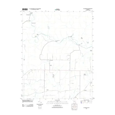
2011 Map of Flatwoods
USGS Topo · Published 2011About this map
The Little Black River meanders across the northern portion of this Ripley County landscape, its course marked by numerous historic crossing points such as Greenville Ford, Paterson Ford, Pennington Ford, and Slayton Ford. This river-centric topography is defined by a series of named drainages and hollows, including Brushy Hollow and Last Chance Hollow, reflecting a long history of rural land use. The settlement at Flatwoods serves as a central point, surrounded by a network of county roads that connect isolated landmarks like Pennington Mill and the Waldemer Flying W Ranch Airport.
Find a feature on this map
45 named features on this map. Tap any name to fly to it.
Don’t see what you’re looking for? This feature index may not catch every label — zoom into the map to look around manually.
Map Details
Editions of this 2011 Flatwoods Map
This is the sole edition of this map. No revisions or reprints were ever made.
Other maps of this area

1934 · Williamsville
USGS Topo · 1:48,000

1935 · Acorn
USGS Topo · 1:62,500

1939 · Doniphan
USGS Topo · 1:62,500

1940 · Williamsville
USGS Topo · 1:62,500

1940 · Naylor
USGS Topo · 1:62,500

1944 · Naylor
USGS Topo · 1:62,500

1944 · Grandin
USGS Topo · 1:62,500

1945 · Doniphan
USGS Topo · 1:62,500

1946 · Grandin
USGS Topo · 1:62,500

1957 · Poplar Bluff
USGS Topo · 1:250,000