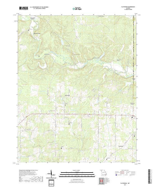
2021 Map of Flatwoods
USGS Topo · Published 2021About this map
The Little Black River and its numerous tributaries, including Flat Cr and Logan Cr, define the drainage patterns of this corner of Southeast Missouri. Small settlements such as Flatwoods and Gamburg serve as local hubs for a rural landscape characterized by a network of state and county roads. The frequency of family-named cemeteries, such as Stevens Cem, McCluskey Cem, and Center Hill Cem, suggests a long-standing community with deep genealogical roots. Historical transit is evident at Greenville Ford and Paterson Ford on the river, points once vital for crossing before modern infrastructure. The terrain is deeply incised by hollows such as Murphy Hollow and Big Spring Hollow, while numerous natural springs like King Bee Spring and Bonanza Spring reflect the region's karst topography and reliable water sources that supported early farmsteads.
Find a feature on this map
59 named features on this map. Tap any name to fly to it.
Don’t see what you’re looking for? This feature index may not catch every label — zoom into the map to look around manually.
Map Details
Editions of this 2021 Flatwoods Map
This is the sole edition of this map. No revisions or reprints were ever made.
Other maps of this area

1934 · Williamsville
USGS Topo · 1:48,000

1935 · Acorn
USGS Topo · 1:62,500

1939 · Doniphan
USGS Topo · 1:62,500

1940 · Williamsville
USGS Topo · 1:62,500

1940 · Naylor
USGS Topo · 1:62,500

1944 · Naylor
USGS Topo · 1:62,500

1944 · Grandin
USGS Topo · 1:62,500

1945 · Doniphan
USGS Topo · 1:62,500

1946 · Grandin
USGS Topo · 1:62,500

1957 · Poplar Bluff
USGS Topo · 1:250,000