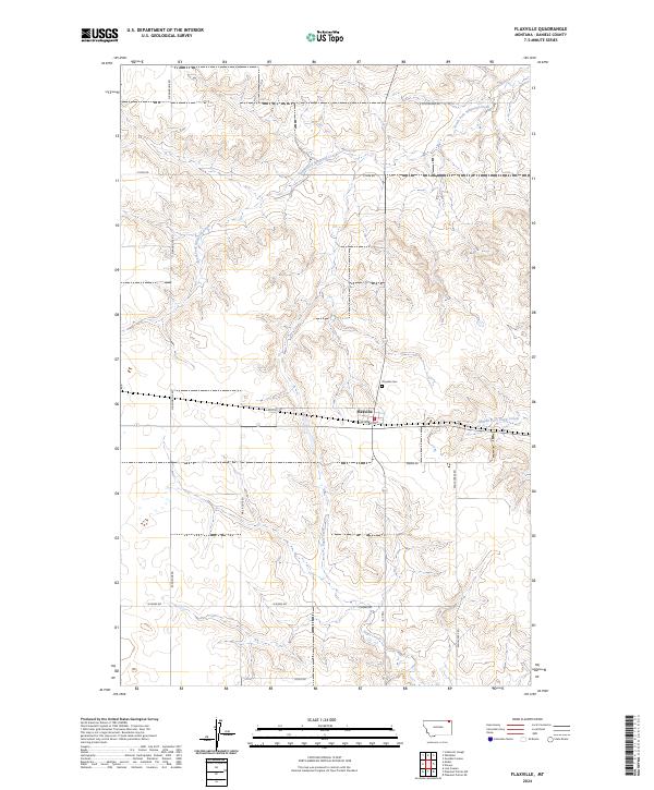
2024 Map of Flaxville
USGS Topo · Published 2024About this map
Flaxville serves as the central hub of this agricultural landscape in northeastern Montana, situated at the junction of Railroad Ave and local routes like Puckett Rd. The town's layout and the surrounding grid of section lines, including N Rangeline Rd and Cross Rd, reflect the organized homesteading patterns of the High Plains. Just north of the town site lies the Flaxville Cem, a critical point of interest for those tracing local family histories.
Find a feature on this map
23 named features on this map. Tap any name to fly to it.
Don’t see what you’re looking for? This feature index may not catch every label — zoom into the map to look around manually.
Map Details
Editions of this 2024 Flaxville Map
This is the sole edition of this map. No revisions or reprints were ever made.
Other maps of this area

1954 · Wolf Point
USGS Topo · 1:250,000

1958 · Wolf Point
USGS Topo · 1:250,000

1973 · Madoc
USGS Topo · 1:24,000

1973 · Flaxville
USGS Topo · 1:24,000

1973 · Whitetail
USGS Topo · 1:24,000

1973 · Navajo
USGS Topo · 1:24,000

1973 · Line Coulee
USGS Topo · 1:24,000

1973 · Pleasant Prairie NW
USGS Topo · 1:24,000

1973 · Goodale Coulee
USGS Topo · 1:24,000

1973 · Si Merrell Slough
USGS Topo · 1:24,000