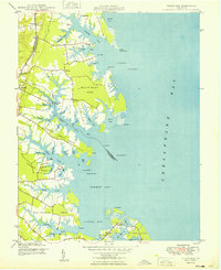
1949 Map of Fleets Bay
USGS Topo · Published 1949About this map
The tidal necks of Lancaster County and Northumberland County define this coastal landscape where the Chesapeake Bay meets an intricate network of creeks and coves. Kilmarnock Wharf stands as a primary maritime access point, reflecting the historical importance of water-based transport for local agriculture and trade during the mid-20th century. Settlement patterns are concentrated along the fingers of land such as Bluff Point Neck and Fleets Bay Neck, with small communities like Byrdton, Ocran, and Foxwells serving as local hubs. Cultural life is anchored by country churches, including Calvary Ch, Asbury Ch, and Maple Grove Ch, which remain key landmarks for genealogists. The map also captures navigational aids like the Old Toms Lt and Cotton Patch Bar Lt, essential for maneuvering the shallow reaches of Fleets Bay and the mouth of Dividing Creek.
Find a feature on this map
68 named features on this map. Tap any name to fly to it.
Don’t see what you’re looking for? This feature index may not catch every label — zoom into the map to look around manually.
Map Details
Editions of this 1949 Fleets Bay Map
2 editions found
Other maps of this area

1916 · Kilmarnock
USGS Topo · 1:48,000

1917 · Heathsville
USGS Topo · 1:48,000

1917 · Kilmarnock
USGS Topo · 1:62,500

1917 · Ewell
USGS Topo · 1:62,500

1942 · Kilmarnock
USGS Topo · 1:62,500

1943 · Richmond
USGS Topo · 1:250,000

1944 · Reedville
USGS Topo · 1:31,680

1948 · Deltaville
USGS Topo · 1:24,000
1949 · Irvington
USGS Topo · 1:24,000
1949 · Wilton
USGS Topo · 1:24,000