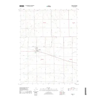
2019 Map of Fleming
USGS Topo · Published 2019About this map
Fleming serves as the central point of this high plains survey in Logan County, where the town grid is defined by streets like E Arapahoe St and E Larimer St. Located north of the town center, Fleming Cem stands as a significant landmark for genealogists and local historians tracking the area's early residents. The surrounding landscape is characterized by a precise network of section-line roads, including Co Rd 44 and Co Rd 28, which parcel the agricultural land between two primary watercourses.
Find a feature on this map
28 named features on this map. Tap any name to fly to it.
Don’t see what you’re looking for? This feature index may not catch every label — zoom into the map to look around manually.
Map Details
Editions of this 2019 Fleming Map
This is the sole edition of this map. No revisions or reprints were ever made.
Other maps of this area

1953 · Tamarack Ranch
USGS Topo · 1:24,000

1953 · Crook
USGS Topo · 1:24,000

1953 · Proctor
USGS Topo · 1:24,000

1954 · Sterling
USGS Topo · 1:250,000

1958 · Sterling
USGS Topo · 1:250,000

1962 · Fleming
USGS Topo · 1:24,000

1962 · Uhler Ranch
USGS Topo · 1:24,000

1962 · Haxtun West
USGS Topo · 1:24,000

1972 · St Petersburg
USGS Topo · 1:24,000

1972 · Rockland
USGS Topo · 1:24,000