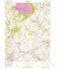
1954 Map of Flemington
USGS Topo · Published 1972About this map
The South Branch Raritan River anchors this mid-century survey of Hunterdon County, where a network of small mill settlements and junctions reflects the area's transition from rural industry to suburban development. The massive Round Valley Reservoir stands out against the backdrop of Cushetunk Mountain, its deep pink shading indicating the significant landscape change brought by the water project.
Find a feature on this map
55 named features on this map. Tap any name to fly to it.
Don’t see what you’re looking for? This feature index may not catch every label — zoom into the map to look around manually.
Map Details
Editions of this 1954 Flemington Map
4 editions found
Other maps of this area

1888 · Princeton
USGS Topo · 1:62,500

1890 · High Bridge
USGS Topo · 1:62,500

1890 · Lambertville
USGS Topo · 1:62,500

1891 · Somerville
USGS Topo · 1:62,500

1891 · Lambertville
USGS Topo · 1:62,500

1893 · Somerville
USGS Topo · 1:62,500

1894 · Princeton
USGS Topo · 1:62,500

1894 · Lambertville
USGS Topo · 1:62,500

1898 · High Bridge
USGS Topo · 1:62,500

1898 · Somerville
USGS Topo · 1:62,500