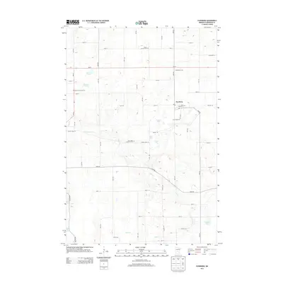
2013 Map of Flensburg
USGS Topo · Published 2013About this map
Flensburg sits at the heart of this central Minnesota landscape, where the agricultural grid meets a complex system of glacial lakes and creeks. The Swan River meanders diagonally across the terrain, passing below Saint John's Lutheran Church and through a landscape dotted with named waters like Beauty Lake, Kuhl Lake, and Little Ganz Lake. The map details the rural character of Morrison County, anchored by local institutions such as the Stavish Dairy Farm and several community burial grounds including Mission Covenant Cem, Swanville Saint Peter Cem, and Sacred Heart Cem. This 2013 survey provides a clear view of the modern road network, from MN-27 to smaller thoroughfares like Badger Creek Rd and Cable Rd, which connect the scattered homesteads and small-scale farms that have long defined the region's economy and social fabric.
Find a feature on this map
40 named features on this map. Tap any name to fly to it.
Don’t see what you’re looking for? This feature index may not catch every label — zoom into the map to look around manually.
Map Details
Editions of this 2013 Flensburg Map
This is the sole edition of this map. No revisions or reprints were ever made.
Other maps of this area

1947 · Flensburg
USGS Topo · 1:25,000

1948 · Belle Prairie
USGS Topo · 1:62,500

1948 · Cushing
USGS Topo · 1:62,500

1948 · Little Falls
USGS Topo · 1:62,500

1950 · Swanville
USGS Topo · 1:62,500

1950 · Belle Prairie
USGS Topo · 1:62,500

1950 · Little Falls
USGS Topo · 1:62,500

1950 · Cushing
USGS Topo · 1:62,500

1951 · Flensburg
USGS Topo · 1:25,000

1953 · Brainerd
USGS Topo · 1:250,000