
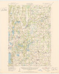
1950 Map of Swanville
USGS Topo · Published 1950About this map
The Northern Pacific railroad corridor serves as the primary artery for this central Minnesota region, connecting the rural centers of Swanville and Flensburg across the Todd and Morrison county lines. The landscape is a complex patchwork of glacial depressions and ridges, defined by the Big Swan Lake and the dense concentration of smaller bodies like Mons Lake and Little Swan Lake. This mid-century view captures the social infrastructure of the time, with numerous town halls such as the Bruce Town Hall and Culdrum Town Hall serving as local civic anchors alongside more than a dozen numbered district schools.
Find a feature on this map
111 named features on this map. Tap any name to fly to it.
Don’t see what you’re looking for? This feature index may not catch every label — zoom into the map to look around manually.
Map Details
Editions of this 1950 Swanville Map
2 editions found
Other maps of this area

1947 · Flensburg
USGS Topo · 1:25,000

1948 · Belle Prairie
USGS Topo · 1:62,500

1948 · Cushing
USGS Topo · 1:62,500

1948 · Little Falls
USGS Topo · 1:62,500

1950 · Belle Prairie
USGS Topo · 1:62,500

1950 · Little Falls
USGS Topo · 1:62,500

1950 · Cushing
USGS Topo · 1:62,500

1951 · Flensburg
USGS Topo · 1:25,000

1953 · Brainerd
USGS Topo · 1:250,000

1953 · Saint Cloud
USGS Topo · 1:250,000