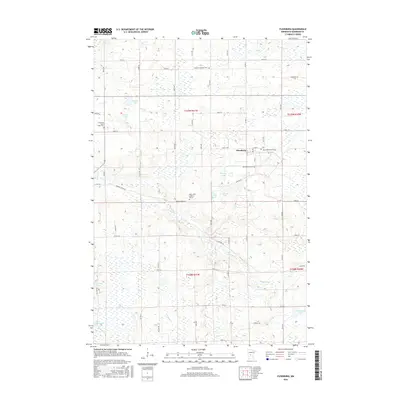
2016 Map of Flensburg
USGS Topo · Published 2016About this map
The Swan River meanders through this portion of Morrison County, creating a landscape defined by expansive wetlands and glacial lakes. The village of Flensburg serves as the central hub of this agricultural and wetland region, characterized by a dense grid of section roads like Badger Creek Rd and Darling Rd. The cultural history of the area is visible through its dispersed religious landmarks, including Saint John's Lutheran Church and several community burial grounds such as Sacred Heart Cem and the Mission Covenant Cem to the north.
Find a feature on this map
56 named features on this map. Tap any name to fly to it.
Don’t see what you’re looking for? This feature index may not catch every label — zoom into the map to look around manually.
Map Details
Editions of this 2016 Flensburg Map
This is the sole edition of this map. No revisions or reprints were ever made.
Other maps of this area

1947 · Flensburg
USGS Topo · 1:25,000

1948 · Belle Prairie
USGS Topo · 1:62,500

1948 · Cushing
USGS Topo · 1:62,500

1948 · Little Falls
USGS Topo · 1:62,500

1950 · Swanville
USGS Topo · 1:62,500

1950 · Belle Prairie
USGS Topo · 1:62,500

1950 · Little Falls
USGS Topo · 1:62,500

1950 · Cushing
USGS Topo · 1:62,500

1951 · Flensburg
USGS Topo · 1:25,000

1953 · Brainerd
USGS Topo · 1:250,000