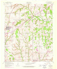
1956 Map of Fletcher
USGS Topo · Published 1976About this map
The Little Washita River winds through the northern portion of this landscape, marking the border between Caddo and Comanche Counties. In the mid-1950s, the town of Fletcher stands as a primary hub, organized along the St Louis - San Francisco railroad line. Cultural landmarks like the Little Washita Indian Church and Washita Indian Cemetery offer significant genealogical value, reflecting the local community's heritage and settlement patterns.
Find a feature on this map
21 named features on this map. Tap any name to fly to it.
Don’t see what you’re looking for? This feature index may not catch every label — zoom into the map to look around manually.
Map Details
Editions of this 1956 Fletcher Map
2 editions found
Other maps of this area

1946 · Lawton
USGS Topo · 1:62,500

1949 · Arbuckle Hill
USGS Topo · 1:24,000

1949 · Cement
USGS Topo · 1:62,500

1949 · Elgin
USGS Topo · 1:24,000

1949 · Nellie
USGS Topo · 1:62,500

1955 · Lawton
USGS Topo · 1:250,000

1956 · Sterling
USGS Topo · 1:24,000

1956 · Laverty
USGS Topo · 1:24,000

1956 · Fletcher
USGS Topo · 1:24,000

1956 · Arbuckle Hill
USGS Topo · 1:24,000