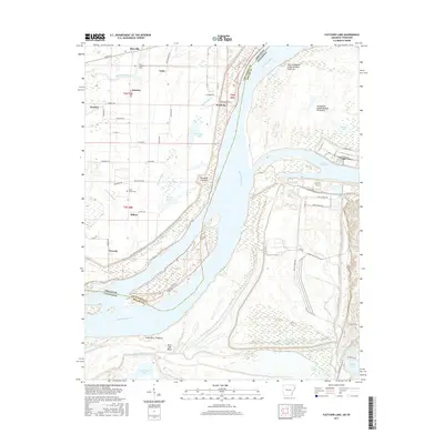
2017 Map of Fletcher Lake
USGS Topo · Published 2017About this map
The Mississippi River creates a complex boundary between Arkansas and Tennessee, defining a landscape of shifting river islands and alluvial lowlands. On the Tennessee side, the industrial and transport infrastructure south of Memphis is evident through Lake McKellar and the sprawling Presidents Island Number Forty-five. Across the water in Arkansas, the terrain is marked by remnants of the river's historical path, including Fletcher Lake, Grassy Lake, and the distinctive Wyanoke Crevasse. Small rural settlements like Wyanoke, Riceville, and Millers are connected by a network of local roads such as Bollinger Rd and Mounds Rd. The map preserves local heritage through the locations of New Salem Cem and Saint Johns Cem, which sit among the bayous and sloughs that characterize the Crittenden County riverfront.
Find a feature on this map
65 named features on this map. Tap any name to fly to it.
Don’t see what you’re looking for? This feature index may not catch every label — zoom into the map to look around manually.
Map Details
Editions of this 2017 Fletcher Lake Map
This is the sole edition of this map. No revisions or reprints were ever made.
Other maps of this area

1908 · Lake Cormorant
USGS Topo · 1:24,000

1912 · Lake Cormorant
USGS Topo · 1:31,680

1916 · Memphis
USGS Topo · 1:62,500

1925 · Memphis
USGS Topo · 1:48,000

1927 · Memphis
USGS Topo · 1:62,500

1931 · Horseshoe Lake
USGS Topo · 1:62,500

1932 · Horn Lake
USGS Topo · 1:48,000

1935 · Horn Lake
USGS Topo · 1:62,500

1939 · Horseshoe Lake
USGS Topo · 1:62,500

1939 · Edmondson
USGS Topo · 1:62,500