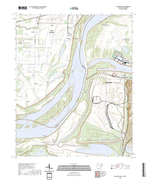
2024 Map of Fletcher Lake
USGS Topo · Published 2024About this map
The Mississippi River creates a dynamic boundary between Arkansas and Tennessee on this survey, carving a complex landscape of islands, sloughs, and bayous. In Crittenden County, the massive Mississippi River Levee stands as a primary engineering feature, protecting small settlements like Riceville and Wyanoke from the river's historical shifts. Evidence of this powerful hydrology is preserved in the naming of the Wyanoke Crevasse, marking a point where the river once breached its banks.
Find a feature on this map
65 named features on this map. Tap any name to fly to it.
Don’t see what you’re looking for? This feature index may not catch every label — zoom into the map to look around manually.
Map Details
Editions of this 2024 Fletcher Lake Map
This is the sole edition of this map. No revisions or reprints were ever made.
Other maps of this area

1908 · Lake Cormorant
USGS Topo · 1:24,000

1912 · Lake Cormorant
USGS Topo · 1:31,680

1916 · Memphis
USGS Topo · 1:62,500

1925 · Memphis
USGS Topo · 1:48,000

1927 · Memphis
USGS Topo · 1:62,500

1931 · Horseshoe Lake
USGS Topo · 1:62,500

1932 · Horn Lake
USGS Topo · 1:48,000

1935 · Horn Lake
USGS Topo · 1:62,500

1939 · Horseshoe Lake
USGS Topo · 1:62,500

1939 · Edmondson
USGS Topo · 1:62,500