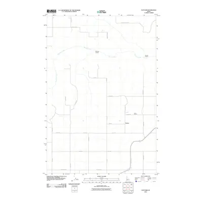
2010 Map of Fletcher
USGS Topo · Published 2010About this map
Fletcher serves as the primary focal point of this rural Nez Perce County landscape, situated amid a grid of local roads that define the region's agricultural character. This high-plateau area of Idaho is carved by deep drainages, most notably Big Canyon Creek and its nearby tributaries like Holes Creek. The terrain is marked by significant topographical relief, including Posthole Canyon and Sixmile Canyon, which interrupt the otherwise orderly layout of farm-to-market routes. Genealogists and local historians will find the location of the Fletcher Cemetery significant, as it remains a central landmark for the surrounding community. The road network, featuring names such as Copenhagen Ridge Rd and Growler Point Rd, reflects the local geography and the enduring patterns of settlement that have persisted into the 21st century.
Find a feature on this map
23 named features on this map. Tap any name to fly to it.
Don’t see what you’re looking for? This feature index may not catch every label — zoom into the map to look around manually.
Map Details
Editions of this 2010 Fletcher Map
This is the sole edition of this map. No revisions or reprints were ever made.
Other maps of this area

1924 · Kamiah
USGS Topo · 1:125,000

1955 · Pullman
USGS Topo · 1:250,000

1958 · Pullman
USGS Topo · 1:250,000

1958 · Culdesac
USGS Topo · 1:62,500

1967 · Mohler
USGS Topo · 1:24,000

1967 · Fletcher
USGS Topo · 1:24,000

1967 · Craigmont
USGS Topo · 1:24,000

1967 · Cottonwood NE
USGS Topo · 1:24,000

1967 · Peck
USGS Topo · 1:24,000

1967 · Orofino West
USGS Topo · 1:24,000