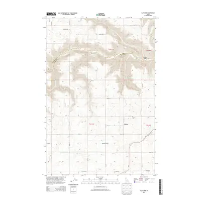
2013 Map of Fletcher
USGS Topo · Published 2013About this map
Fletcher stands at the heart of this Idaho landscape, where the plateau agriculture of the Camas Prairie meets the deeply incised drainage systems of the Nez Perce and Lewis County line. The settlement is anchored by the Fletcher Cem, a vital site for local genealogical research, and is surrounded by a network of family-named roads including Laufers Rd, Dunlap Rd, and Patton Rd. These routes trace the high ground between significant geological depressions, most notably the winding descent of Big Canyon Cr and the stark topography of Posthole Canyon. The map reveals a transition from managed farmland to the more dramatic terrain found along Copenhagen Ridge Rd and Sixmile Canyon, illustrating the relationship between the regional road network and the challenging hydrology of Holes Cr.
Find a feature on this map
31 named features on this map. Tap any name to fly to it.
Don’t see what you’re looking for? This feature index may not catch every label — zoom into the map to look around manually.
Map Details
Editions of this 2013 Fletcher Map
This is the sole edition of this map. No revisions or reprints were ever made.
Other maps of this area

1924 · Kamiah
USGS Topo · 1:125,000

1955 · Pullman
USGS Topo · 1:250,000

1958 · Pullman
USGS Topo · 1:250,000

1958 · Culdesac
USGS Topo · 1:62,500

1967 · Mohler
USGS Topo · 1:24,000

1967 · Fletcher
USGS Topo · 1:24,000

1967 · Craigmont
USGS Topo · 1:24,000

1967 · Cottonwood NE
USGS Topo · 1:24,000

1967 · Peck
USGS Topo · 1:24,000

1967 · Orofino West
USGS Topo · 1:24,000