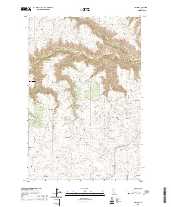
2024 Map of Fletcher
USGS Topo · Published 2024About this map
The settlement of Fletcher serves as the focal point of this Lewis County survey, situated on an elevated plateau between significant canyon systems. The landscape is defined by the deep carving of Big Canyon Creek along the northern boundary, which follows the line between Nez Perce and Lewis Counties. This topographical contrast between the high agricultural lands and the steep drainage of Posthole Canyon and Sixmile Canyon illustrates the transition from the rolling prairie heights down toward the Clearwater River watershed. A systematic network of roads, such as Airport North Rd and Meridian Rd, follows the section lines of the Public Land Survey System, specifically within Township 34 North, Range 1 West. Local history is anchored by the Fletcher Cem and a series of family-named roads like Laufers Rd and Furnish Rd, marking the long-term patterns of land ownership in this Idaho panhandle region.
Find a feature on this map
32 named features on this map. Tap any name to fly to it.
Don’t see what you’re looking for? This feature index may not catch every label — zoom into the map to look around manually.
Map Details
Editions of this 2024 Fletcher Map
This is the sole edition of this map. No revisions or reprints were ever made.
Other maps of this area

1924 · Kamiah
USGS Topo · 1:125,000

1955 · Pullman
USGS Topo · 1:250,000

1958 · Pullman
USGS Topo · 1:250,000

1958 · Culdesac
USGS Topo · 1:62,500

1967 · Mohler
USGS Topo · 1:24,000

1967 · Fletcher
USGS Topo · 1:24,000

1967 · Craigmont
USGS Topo · 1:24,000

1967 · Cottonwood NE
USGS Topo · 1:24,000

1967 · Peck
USGS Topo · 1:24,000

1967 · Orofino West
USGS Topo · 1:24,000