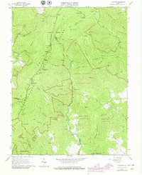
1965 Map of Fletcher
USGS Topo · Published 1979About this map
Shenandoah National Park dominates this mid-1960s landscape at the boundary of Page, Greene, and Madison counties. The survey highlights the high-elevation recreation corridor of Skyline Drive, featuring several overlooks such as The Point and The Oaks Overlook, alongside the Appalachian Trail. Beyond the scenic ridge, the map traces the deep interior drainages of the Conway River and Rapidan River, where the historic Rapidan Camp is situated. Lower-elevation settlements like Fletcher provide a glimpse into the community life of the Virginia Blue Ridge, anchored by institutions like the Middle River Chapel, Shiloh Ch, and the Meadow School. The terrain is characterized by named ridges and peaks such as Fork Mountain and Jones Mountain, while legacy sites like the Lower Pocosin Mission and South River Cem offer significant points of interest for local genealogy and land-use history.
Find a feature on this map
81 named features on this map. Tap any name to fly to it.
Don’t see what you’re looking for? This feature index may not catch every label — zoom into the map to look around manually.
Map Details
Editions of this 1965 Fletcher Map
4 editions found
Other maps of this area

1892 · Woodstock
USGS Topo · 1:125,000

1892 · Gordonsville
USGS Topo · 1:125,000

1892 · Harrisonburg
USGS Topo · 1:125,000

1893 · Luray
USGS Topo · 1:125,000

1905 · Luray
USGS Topo · 1:125,000

1929 · Stony Man
USGS Topo · 1:48,000

1930 · Madison
USGS Topo · 1:48,000

1933 · Stony Man
USGS Topo · 1:62,500

1933 · Madison
USGS Topo · 1:62,500

1937 · Elkton
USGS Topo · 1:62,500