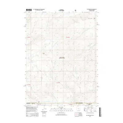
2015 Map of Fletcher Peak
USGS Topo · Published 2015About this map
Fletcher Peak and the high ridge of the Continental Divide dominate this high-altitude landscape along the border of Colorado and Wyoming. Within the Sierra Madre range, the terrain is defined by a dense network of mountain drainages, including Battle Cr and the complex headwaters of the Roaring Fork Little Snake River. The transition between the Medicine Bow National Forest in Wyoming and the Routt National Forest in Colorado is marked by steep elevation changes and narrow valleys like Cherry Draw. While much of the land remains wild forest, the presence of the Hackmaster Ditch and primitive routes like Stock Dr indicate the historical importance of water management and livestock movement through these passes. The map captures the meeting point of Carbon County and Routt County, illustrating the remote topography where the Rockies cross state lines.
Find a feature on this map
29 named features on this map. Tap any name to fly to it.
Don’t see what you’re looking for? This feature index may not catch every label — zoom into the map to look around manually.
Map Details
Editions of this 2015 Fletcher Peak Map
This is the sole edition of this map. No revisions or reprints were ever made.
Other maps of this area

1911 · Hahns Peak
USGS Topo · 1:125,000

1913 · Hahns Peak
USGS Topo · 1:125,000

1932 · Savery
USGS Topo · 1:96,000

1939 · Saratoga
USGS Topo · 1:125,000

1940 · Savery
USGS Topo · 1:125,000

1954 · Rawlins
USGS Topo · 1:250,000

1954 · Craig
USGS Topo · 1:250,000

1957 · Craig
USGS Topo · 1:250,000

1958 · Rawlins
USGS Topo · 1:250,000

1958 · Craig
USGS Topo · 1:250,000