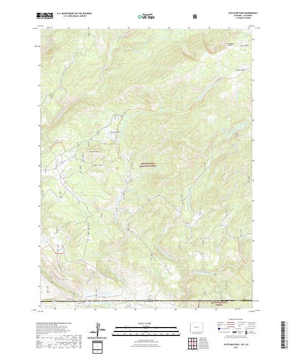
2021 Map of Fletcher Peak
USGS Topo · Published 2021About this map
Fletcher Peak dominates this high-altitude landscape where the Continental Divide winds through the Sierra Madre range. Situated on the border between Wyoming and Colorado, the map illustrates a complex network of alpine drainage systems, including the Little Snake River and its various forks. The intersection of the Medicine Bow National Forest and Routt National Forest highlights the managed wilderness character of the region.
Find a feature on this map
34 named features on this map. Tap any name to fly to it.
Don’t see what you’re looking for? This feature index may not catch every label — zoom into the map to look around manually.
Map Details
Editions of this 2021 Fletcher Peak Map
This is the sole edition of this map. No revisions or reprints were ever made.
Other maps of this area

1911 · Hahns Peak
USGS Topo · 1:125,000

1913 · Hahns Peak
USGS Topo · 1:125,000

1932 · Savery
USGS Topo · 1:96,000

1939 · Saratoga
USGS Topo · 1:125,000

1940 · Savery
USGS Topo · 1:125,000

1954 · Rawlins
USGS Topo · 1:250,000

1954 · Craig
USGS Topo · 1:250,000

1957 · Craig
USGS Topo · 1:250,000

1958 · Rawlins
USGS Topo · 1:250,000

1958 · Craig
USGS Topo · 1:250,000