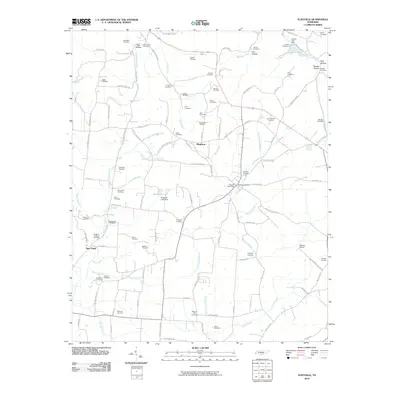
2010 Map of Flintville
USGS Topo · Published 2010About this map
The Flint River carves a central path through this Lincoln County landscape, serving as a primary geographical anchor for the communities of Flintville, New Hope, and Brighton. This 2010 survey highlights a deeply ingrained rural cemetery network that provides significant genealogical value, including family-named sites such as the Taylor-Gray Cemetery, Harris-Jean Cemetery, and the Hopkins-Eastland Cemetery.
Find a feature on this map
120 named features on this map. Tap any name to fly to it.
Don’t see what you’re looking for? This feature index may not catch every label — zoom into the map to look around manually.
Map Details
Editions of this 2010 Flintville Map
This is the sole edition of this map. No revisions or reprints were ever made.
Other maps of this area

1888 · Scottsboro
USGS Topo · 1:125,000

1888 · Huntsville
USGS Topo · 1:125,000

1892 · Huntsville
USGS Topo · 1:125,000

1892 · Scottsboro
USGS Topo · 1:125,000

1936 · King Cove
USGS Topo · 1:24,000

1936 · Flintville
USGS Topo · 1:24,000

1936 · Fisk
USGS Topo · 1:24,000

1936 · Lincoln
USGS Topo · 1:24,000

1936 · Huntland
USGS Topo · 1:24,000
1936 · New Market
USGS Topo · 1:24,000