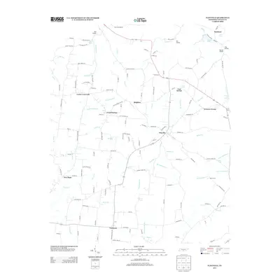
2013 Map of Flintville
USGS Topo · Published 2013About this map
The Flint River meanders through this portion of Lincoln County, south of the Alabama border, anchoring a landscape defined by small rural hubs and a network of named springs. This 2013 survey illustrates the area surrounding Flintville, where the river is joined by various tributaries including Mulepen Cr and Big Huckleberry Cr. The presence of Milners Switch reflects the historical railroad alignment that once served the local timber or agricultural economy. Local geography is deeply tied to water sources, marked by features such as Crystal Springs, Gum Spring, and Nixon Spring. Low-lying areas like Sycamore Swamp and the various hollows, including Gin Hollow and Teal Hollow, contrast with the upland road networks connecting Corder Crossroads and Brighton. This map is a record of local family-named landmarks and long-established communities like New Hope and Vanntown, providing a clear view of the rural settlement patterns in south-central Tennessee.
Find a feature on this map
133 named features on this map. Tap any name to fly to it.
Don’t see what you’re looking for? This feature index may not catch every label — zoom into the map to look around manually.
Map Details
Editions of this 2013 Flintville Map
This is the sole edition of this map. No revisions or reprints were ever made.
Other maps of this area

1888 · Scottsboro
USGS Topo · 1:125,000

1888 · Huntsville
USGS Topo · 1:125,000

1892 · Huntsville
USGS Topo · 1:125,000

1892 · Scottsboro
USGS Topo · 1:125,000

1936 · King Cove
USGS Topo · 1:24,000

1936 · Flintville
USGS Topo · 1:24,000

1936 · Fisk
USGS Topo · 1:24,000

1936 · Lincoln
USGS Topo · 1:24,000

1936 · Huntland
USGS Topo · 1:24,000
1936 · New Market
USGS Topo · 1:24,000