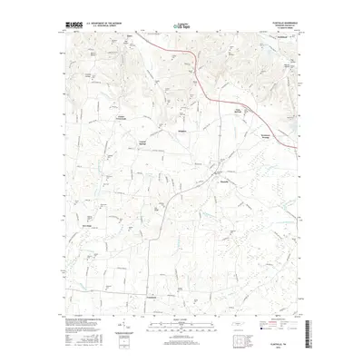
2016 Map of Flintville
USGS Topo · Published 2016About this map
Flintville and Crystal Springs anchor this landscape in Lincoln County, where the Flint River carves a path through numerous hollows and ridges. The map reveals a dense network of family-named cemeteries and landmarks, such as the Harris-Jean Cem and Hopkins-Eastland Cem, which provide significant value for genealogical research in this rural Tennessee corridor. The terrain is defined by its water sources, from the Lincoln Lake in the northeast to the springs that give Crystal Springs its name.
Find a feature on this map
148 named features on this map. Tap any name to fly to it.
Don’t see what you’re looking for? This feature index may not catch every label — zoom into the map to look around manually.
Map Details
Editions of this 2016 Flintville Map
This is the sole edition of this map. No revisions or reprints were ever made.
Other maps of this area

1888 · Scottsboro
USGS Topo · 1:125,000

1888 · Huntsville
USGS Topo · 1:125,000

1892 · Huntsville
USGS Topo · 1:125,000

1892 · Scottsboro
USGS Topo · 1:125,000

1936 · King Cove
USGS Topo · 1:24,000

1936 · Flintville
USGS Topo · 1:24,000

1936 · Fisk
USGS Topo · 1:24,000

1936 · Lincoln
USGS Topo · 1:24,000

1936 · Huntland
USGS Topo · 1:24,000
1936 · New Market
USGS Topo · 1:24,000