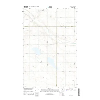
2014 Map of Flora SE
USGS Topo · Published 2014About this map
The Sheyenne River winds through this rural landscape at the intersection of Benson, Wells, and Eddy counties. In this northern plains environment, the river’s path is the defining natural feature, cutting through terrain primarily organized by a rigid grid of agricultural section lines and county roads. Transportation is facilitated by local routes such as Co Road 12 and Cr-12, which serve as the primary conduits for the scattered farmsteads and rural operations in this region.
Find a feature on this map
21 named features on this map. Tap any name to fly to it.
Don’t see what you’re looking for? This feature index may not catch every label — zoom into the map to look around manually.
Map Details
Editions of this 2014 Flora SE Map
This is the sole edition of this map. No revisions or reprints were ever made.
Other maps of this area

1931 · Oberon
USGS Topo · 1:62,500

1932 · Flora
USGS Topo · 1:62,500

1948 · New Rockford
USGS Topo · 1:62,500

1948 · Cathay
USGS Topo · 1:62,500

1948 · Bremen
USGS Topo · 1:24,000

1949 · Bremen
USGS Topo · 1:24,000

1949 · Munster
USGS Topo · 1:24,000

1950 · New Rockford
USGS Topo · 1:24,000

1950 · Oberon SW
USGS Topo · 1:24,000

1950 · Oberon
USGS Topo · 1:62,500