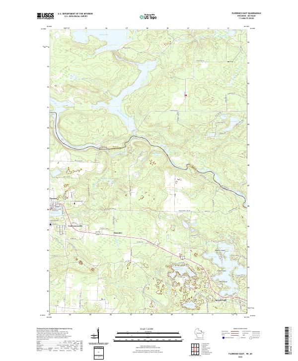
2022 Map of Florence East
USGS Topo · Published 2022About this map
The Menominee River, Michigamme River, and Brule River converge along the Wisconsin-Michigan state line, creating a landscape defined by complex hydrology and timberland history. This 2022 survey captures the region's primary settlements at Florence and Commonwealth, where the Florence County Courthouse stands as a central civic landmark. The terrain is dotted with significant glacial water bodies, from the broad Peavy Pond in the north to the chain of lakes in the south near Spread Eagle, including West Lake, Cosgrove Lake, and Lake Anna.
Find a feature on this map
95 named features on this map. Tap any name to fly to it.
Don’t see what you’re looking for? This feature index may not catch every label — zoom into the map to look around manually.
Map Details
Editions of this 2022 Florence East Map
This is the sole edition of this map. No revisions or reprints were ever made.
Other maps of this area

1899 · Sagola
USGS Topo · 1:62,500

1899 · Crystal Falls
USGS Topo · 1:62,500

1939 · Iron Mountain
USGS Topo · 1:48,000

1941 · Florence
USGS Topo · 1:48,000

1941 · Iron Mountain
USGS Topo · 1:48,000

1944 · Crystal Falls
USGS Topo · 1:24,000

1946 · Crystal Falls
USGS Topo · 1:31,680

1947 · Iron Mountain
USGS Topo · 1:48,000

1947 · Stager
USGS Topo · 1:24,000

1947 · Lake Mary
USGS Topo · 1:24,000