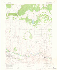
1959 Map of Florence
USGS Topo · Published 1963About this map
The Arkansas River corridor serves as the industrial and logistical spine for this 1959 survey, where the Denver and Rio Grande Western Railroad connects the settlements of Florence and Portland. The landscape transitions from the river valley into a complex network of canyons and plateaus to the north, characterized by the dramatic Phantom Canyon and the Brush Hollow Reservoir. Significant local infrastructure is evident at the Fremont County Airport and the University of Oklahoma Summer Geology Camp, which highlights the area's geological importance for academic study during the mid-century.
Find a feature on this map
30 named features on this map. Tap any name to fly to it.
Don’t see what you’re looking for? This feature index may not catch every label — zoom into the map to look around manually.
Map Details
Editions of this 1959 Florence Map
5 editions found

Other maps of this area

1889 · Canon City
USGS Topo · 1:125,000

1891 · Pueblo
USGS Topo · 1:125,000

1892 · Canon City
USGS Topo · 1:125,000

1893 · Colorado Springs
USGS Topo · 1:125,000

1894 · Pikes Peak
USGS Topo · 1:125,000

1894 · Pueblo
USGS Topo · 1:125,000

1896 · Pueblo
USGS Topo · 1:125,000

1897 · Pueblo
USGS Topo · 1:125,000

1901 · Pikes Peak
USGS Topo · 1:125,000

1909 · Colorado Springs
USGS Topo · 1:125,000