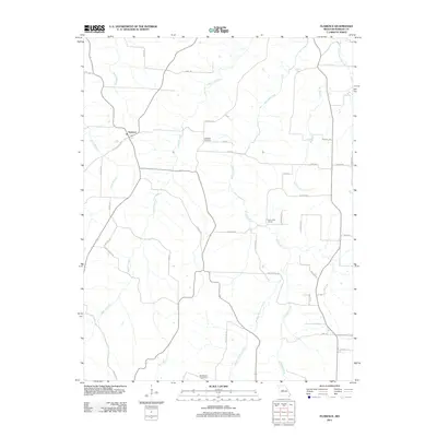
2011 Map of Florence
USGS Topo · Published 2011About this map
The unincorporated settlement of Florence serves as the focal point for this landscape in Morgan County, where a network of rural roads and creek branches defines the local geography. The map captures a detailed view of the rural infrastructure, including the historic path of the Butterfield Trl, which reflects the area's long-standing role in regional transit. Waterways like Richland Creek, Gabriel Creek, and Middle Richland Creek carve through the terrain, illustrating the drainage patterns that have shaped local agriculture and land use.
Find a feature on this map
44 named features on this map. Tap any name to fly to it.
Don’t see what you’re looking for? This feature index may not catch every label — zoom into the map to look around manually.
Map Details
Editions of this 2011 Florence Map
This is the sole edition of this map. No revisions or reprints were ever made.
Other maps of this area

1887 · Sedalia
USGS Topo · 1:125,000

1887 · Warsaw
USGS Topo · 1:125,000

1888 · Versailles
USGS Topo · 1:125,000

1888 · Boonville
USGS Topo · 1:125,000

1893 · Versailles
USGS Topo · 1:125,000

1894 · Warsaw
USGS Topo · 1:125,000

1894 · Sedalia
USGS Topo · 1:125,000

1904 · Gravois Mills
USGS Topo · 1:62,500

1947 · Jefferson City
USGS Topo · 1:250,000

1949 · Gravois Mills
USGS Topo · 1:62,500