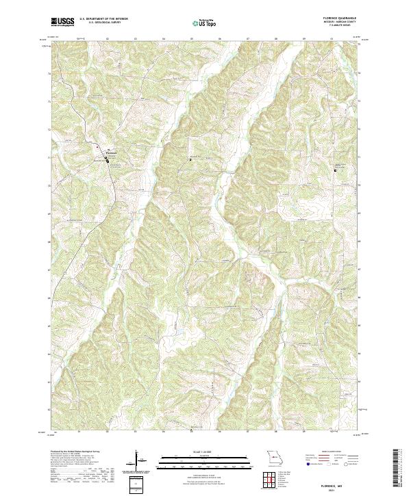
2021 Map of Florence
USGS Topo · Published 2021About this map
Florence anchors this portion of Morgan County, serving as a focal point for local history with several long-standing community sites including the Florence Union Cem, the Methodist Cem, and the United Church of Christ Cem. The landscape is defined by the dendritic drainage patterns of the Richland Cr and Gabriel Cr systems, which cut through the terrain. A notable historical thread is visible in the road network, specifically the Butterfield Trl Rd and the Butterfield Cutoff, which trace paths through the western section of the quadrangle. Rural life is further evidenced by isolated landmarks like the Mount Carmel Baptist Church Cem to the east and the Bethlehem Cem to the south, marking the distribution of early family and congregational settlements across the countryside.
Find a feature on this map
51 named features on this map. Tap any name to fly to it.
Don’t see what you’re looking for? This feature index may not catch every label — zoom into the map to look around manually.
Map Details
Editions of this 2021 Florence Map
This is the sole edition of this map. No revisions or reprints were ever made.
Other maps of this area

1887 · Sedalia
USGS Topo · 1:125,000

1887 · Warsaw
USGS Topo · 1:125,000

1888 · Versailles
USGS Topo · 1:125,000

1888 · Boonville
USGS Topo · 1:125,000

1893 · Versailles
USGS Topo · 1:125,000

1894 · Warsaw
USGS Topo · 1:125,000

1894 · Sedalia
USGS Topo · 1:125,000

1904 · Gravois Mills
USGS Topo · 1:62,500

1947 · Jefferson City
USGS Topo · 1:250,000

1949 · Gravois Mills
USGS Topo · 1:62,500