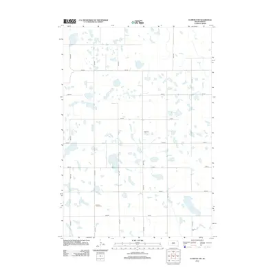
2012 Map of Florence NW
USGS Topo · Published 2012About this map
Glacial depressions and small prairie wetlands dominate this portion of Eden Township during the early twenty-first century. The landscape is structured by a rigid grid of section roads, including 150th St and 439th Ave, which carve the terrain into a predictable agricultural pattern. Scattered throughout these fields are several small burying grounds that serve as focal points for the local rural community. The Saint Pauli Lutheran Cem sits in the southern portion of the quadrangle, while Wheatland Cem and Goodhue Cem are positioned along the north-south corridors of the township. These cemeteries represent the primary enduring landmarks in an area otherwise characterized by its agricultural rhythm and numerous unnamed water bodies.
Find a feature on this map
17 named features on this map. Tap any name to fly to it.
Don’t see what you’re looking for? This feature index may not catch every label — zoom into the map to look around manually.
Map Details
Editions of this 2012 Florence NW Map
This is the sole edition of this map. No revisions or reprints were ever made.
Other maps of this area

1953 · Milbank
USGS Topo · 1:250,000

1958 · Milbank
USGS Topo · 1:250,000

1970 · Waubay
USGS Topo · 1:24,000

1970 · Florence NE
USGS Topo · 1:24,000

1970 · Waubay SW
USGS Topo · 1:24,000

1973 · Florence
USGS Topo · 1:24,000

1973 · Webster
USGS Topo · 1:24,000

1973 · Swan Lake
USGS Topo · 1:24,000

1973 · Florence NW
USGS Topo · 1:24,000

1973 · Wallace
USGS Topo · 1:24,000