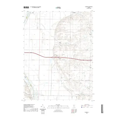
2021 Map of Florence
USGS Topo · Published 2021About this map
The Illinois River forms a major geographic boundary along the western edge of this Scott County landscape, separating it from Pike County. Small settlements like Naples, Bluffs, Exeter, and Florence are connected by a network of rural roads that wind through the upland drainage basins of Mauvaise Terre Creek and Walnut Creek. The area is characterized by a significant density of family and community burial grounds, reflecting deep ancestral ties to the land. Features such as the Mitchell Family Cemetery and Ellis Family Cemetery are scattered across the terrain, often located near small watercourses or ridges.
Find a feature on this map
60 named features on this map. Tap any name to fly to it.
Don’t see what you’re looking for? This feature index may not catch every label — zoom into the map to look around manually.
Map Details
Editions of this 2021 Florence Map
This is the sole edition of this map. No revisions or reprints were ever made.
Other maps of this area

1924 · Winchester
USGS Topo · 1:48,000

1924 · Griggsville
USGS Topo · 1:62,500

1926 · Griggsville
USGS Topo · 1:62,500

1926 · Winchester
USGS Topo · 1:62,500

1928 · Meredosia
USGS Topo · 1:62,500

1929 · Arenzville
USGS Topo · 1:62,500

1931 · Meredosia
USGS Topo · 1:62,500

1932 · Arenzville
USGS Topo · 1:62,500

1948 · Quincy
USGS Topo · 1:250,000

1956 · Quincy
USGS Topo · 1:250,000