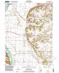
1998 Map of Florence
USGS Topo · Published 2003About this map
The Illinois River carves a deep boundary between Pike and Scott counties, defining a landscape where expansive river bottomlands meet the rising bluffs of central Illinois. Settlement patterns are concentrated along the high ground, with villages like Exeter and Bluffs positioned away from the flood-prone flats. The western portion of the sheet is dominated by the Ray Norbut State Fish and Wildlife Area, an area characterized by backwater features like Jack Pilot Lake and Ferry Lake.
Find a feature on this map
39 named features on this map. Tap any name to fly to it.
Don’t see what you’re looking for? This feature index may not catch every label — zoom into the map to look around manually.
Map Details
Editions of this 1998 Florence Map
This is the sole edition of this map. No revisions or reprints were ever made.
Other maps of this area

1924 · Winchester
USGS Topo · 1:48,000

1924 · Griggsville
USGS Topo · 1:62,500

1926 · Griggsville
USGS Topo · 1:62,500

1926 · Winchester
USGS Topo · 1:62,500

1928 · Meredosia
USGS Topo · 1:62,500

1929 · Arenzville
USGS Topo · 1:62,500

1931 · Meredosia
USGS Topo · 1:62,500

1932 · Arenzville
USGS Topo · 1:62,500

1948 · Quincy
USGS Topo · 1:250,000

1956 · Quincy
USGS Topo · 1:250,000