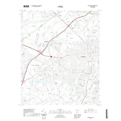
2020 Map of Florence West
USGS Topo · Published 2020About this map
The western edges of Florence are defined by the convergence of major transit corridors and the winding course of Middle Swamp and Jeffries Cr. This contemporary landscape highlights the transition from a traditional rail and trade hub to a modern commercial center, where historic names like Coles Crossing and Hoffmeyer Crossroads persist alongside suburban development. The northern boundary is established by the Darlington Co Florence Co line, where the Florence - Darlington Technical Coll sits near the headwaters of High Hill Cr. To the south and west, the map records numerous memorial sites, including Mount Hope Cem, Florence Memorial Gardens, and Sunset Memory Gardens, reflecting the city's long-established community footprint. Natural drainage patterns remain prominent, from the wide basin of Morris Bay to the managed waters at Forest Lake and Muldrows Mill-Pond, illustrating how the coastal plain's hydrology continues to shape the city's western expansion.
Find a feature on this map
205 named features on this map. Tap any name to fly to it.
Don’t see what you’re looking for? This feature index may not catch every label — zoom into the map to look around manually.
Map Details
Editions of this 2020 Florence West Map
This is the sole edition of this map. No revisions or reprints were ever made.
Other maps of this area

1940 · Florence West
USGS Topo · 1:62,500

1940 · Florence East
USGS Topo · 1:62,500

1943 · Gum Swamp
USGS Topo · 1:62,500

1945 · Florence East
USGS Topo · 1:62,500

1945 · Florence West
USGS Topo · 1:62,500

1953 · Florence
USGS Topo · 1:250,000

1954 · Florence
USGS Topo · 1:250,000

1963 · Darlington East
USGS Topo · 1:24,000

1963 · Darlington West
USGS Topo · 1:24,000
1972 · Witherspoon Island
USGS Topo · 1:24,000