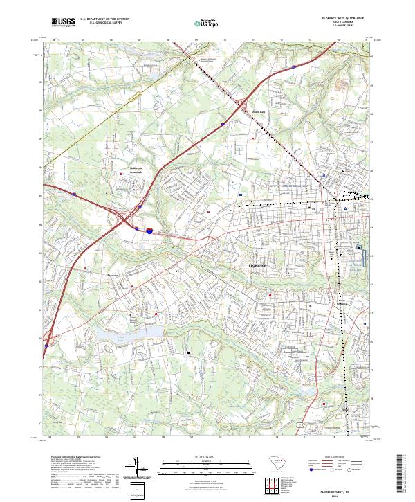
2024 Map of Florence West
USGS Topo · Published 2024About this map
Florence serves as a primary hub where the historical boundaries of Darlington Co and Florence Co meet. The landscape is defined by its deep community roots, evidenced by a high density of commemorative spaces including the Florence National Cemetery, the Hebrew Benevolent Society Cem, and several others like Mount Hope Cem. This network of cemeteries and the Florence Memorial Gardens underscores the long-standing settlement patterns of the region.
Find a feature on this map
394 named features on this map. Tap any name to fly to it.
Don’t see what you’re looking for? This feature index may not catch every label — zoom into the map to look around manually.
Map Details
Editions of this 2024 Florence West Map
This is the sole edition of this map. No revisions or reprints were ever made.
Other maps of this area

1940 · Florence West
USGS Topo · 1:62,500

1940 · Florence East
USGS Topo · 1:62,500

1943 · Gum Swamp
USGS Topo · 1:62,500

1945 · Florence East
USGS Topo · 1:62,500

1945 · Florence West
USGS Topo · 1:62,500

1953 · Florence
USGS Topo · 1:250,000

1954 · Florence
USGS Topo · 1:250,000

1963 · Darlington East
USGS Topo · 1:24,000

1963 · Darlington West
USGS Topo · 1:24,000
1972 · Witherspoon Island
USGS Topo · 1:24,000