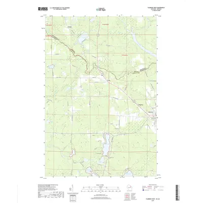
2018 Map of Florence West
USGS Topo · Published 2018About this map
The Brule River and Paint River define the jurisdictional boundary between Iron County, Michigan, and Florence County, Wisconsin, as seen in this 2018 survey. The landscape is dominated by glacial water bodies, including the notable Keyes Lake, Sea Lion Lake, and the aptly named Dead Mans Lake near Stager. These waterways were central to the region’s development, providing recreation and drainage for the surrounding timberlands.
Find a feature on this map
79 named features on this map. Tap any name to fly to it.
Don’t see what you’re looking for? This feature index may not catch every label — zoom into the map to look around manually.
Map Details
Editions of this 2018 Florence West Map
This is the sole edition of this map. No revisions or reprints were ever made.
Other maps of this area

1899 · Sagola
USGS Topo · 1:62,500

1899 · Crystal Falls
USGS Topo · 1:62,500

1939 · Iron Mountain
USGS Topo · 1:48,000

1941 · Florence
USGS Topo · 1:48,000

1941 · Iron Mountain
USGS Topo · 1:48,000

1944 · Crystal Falls
USGS Topo · 1:24,000

1944 · Fortune Lakes
USGS Topo · 1:24,000

1946 · Crystal Falls
USGS Topo · 1:31,680

1946 · Fortune Lakes
USGS Topo · 1:31,680

1947 · Naults
USGS Topo · 1:24,000